Gurgaon — The City at a Glance
Representative aerial and corridor imagery illustrating the scale of NCR high-rise development. Sector maps and sourced data visuals below.


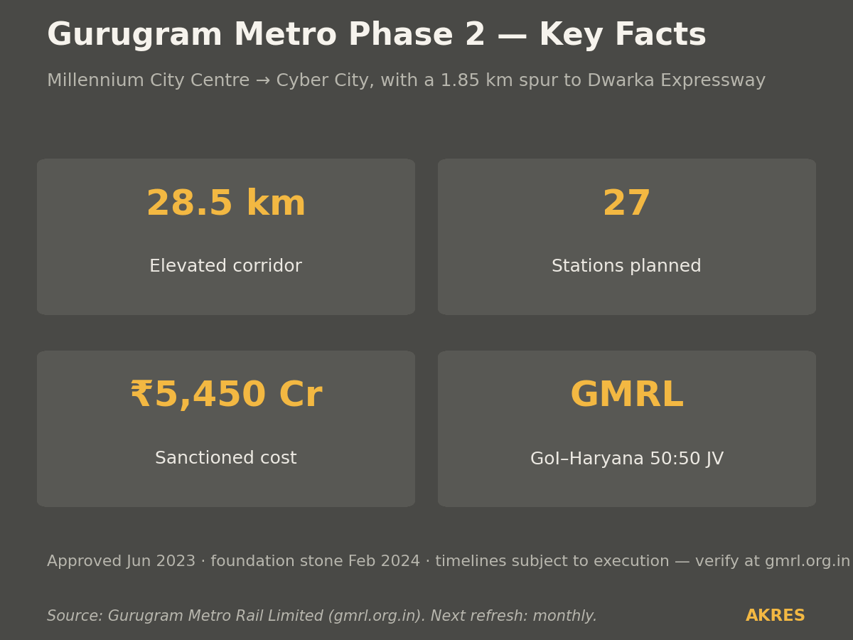
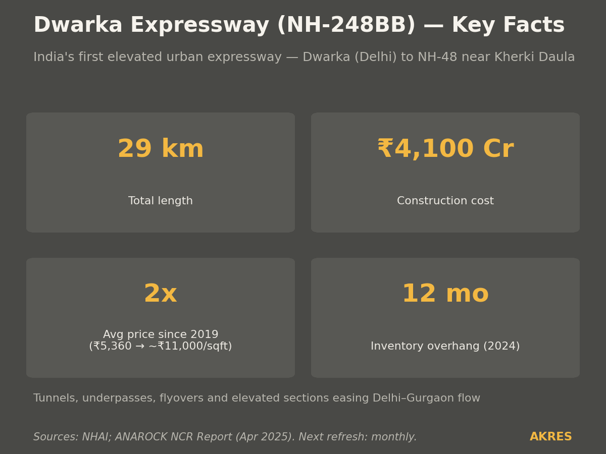
Connectivity and Development
Metro, expressway, and planned infrastructure that drives micro-market valuation. Sourced from GMRL, NHAI, and Anarock — dated at source.
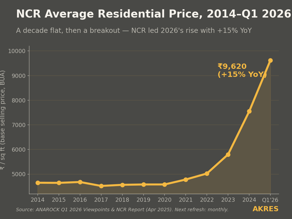
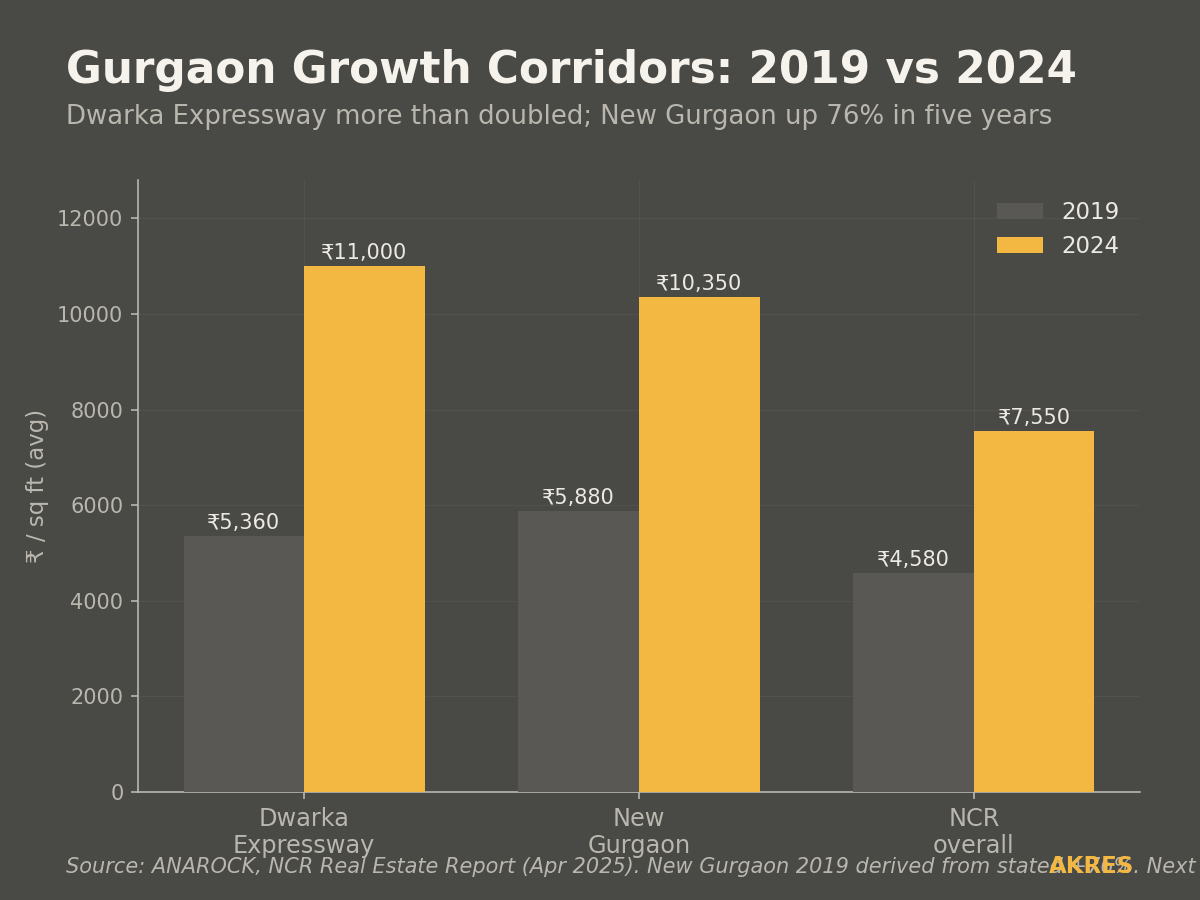
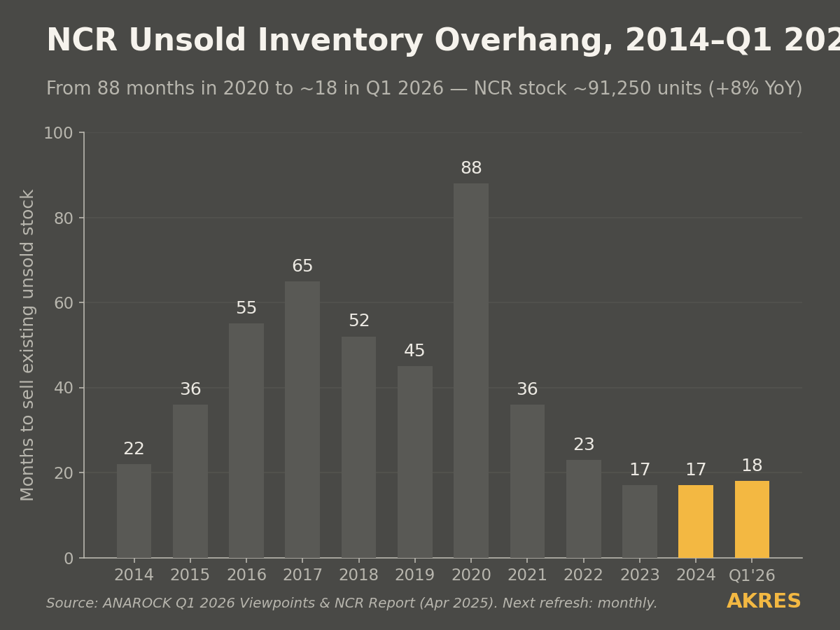
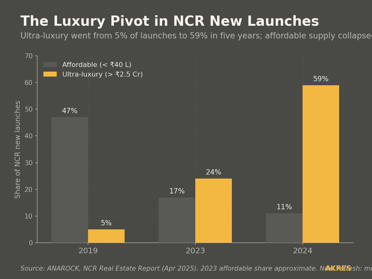
Pricing and Inventory Trends
Data visualisations built from Anarock research and official portals. Each chart carries its source and date. Refreshed monthly.
The Residential Landscape
Urban density, infrastructure corridors, and the scale of residential development across Gurgaon's micro-markets.


About These Visuals
All maps and data charts are based on publicly available information sourced from HARERA, DTCP, Anarock, JLL, and portal data as cited. Photographs are representative stock imagery unless captioned otherwise. No project names, builder names, or exact addresses are visible in any published image — per our client information policy. Dates reflect when the source data was current.